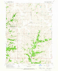
1965 Map of Garden Grove
USGS Topo · Published 1967About this map
Garden Grove and its surrounding townships in Decatur and Wayne Counties are defined by the intricate drainage networks of the southern Iowa prairie. The landscape is carved by the Chariton River and Mormon Creek, with numerous smaller tributaries like Steel Creek and Hunters Creek creating a deeply dissected topography. Transportation in the mid-1960s relied on the Chicago Burlington and Quincy railroad, which cuts through the central portion of the map, supporting small agricultural centers like Humeston. The presence of the Green Bay Cem. and Lewisburg Cem offers specific points of interest for genealogists tracing local families in these rural townships. Cultural landmarks of the era, such as a Radio Tower and a Drive-in Theater near the southern boundary, highlight the mid-century development of the region beyond its strictly agrarian roots.
Find a feature on this map
19 named features on this map. Tap any name to fly to it.
Don’t see what you’re looking for? This feature index may not catch every label — zoom into the map to look around manually.
Map Details
Editions of this 1965 Garden Grove Map
This is the sole edition of this map. No revisions or reprints were ever made.
Other maps of this area

1934 · Humeston
USGS Topo · 1:48,000

1937 · Corydon
USGS Topo · 1:62,500

1954 · Centerville
USGS Topo · 1:250,000

1957 · Centerville
USGS Topo · 1:250,000

1958 · Centerville
USGS Topo · 1:250,000

1964 · Woodland
USGS Topo · 1:24,000

1964 · Leon
USGS Topo · 1:24,000

1964 · Clio
USGS Topo · 1:24,000

1965 · Weldon
USGS Topo · 1:24,000

1965 · Garden Grove SW
USGS Topo · 1:24,000