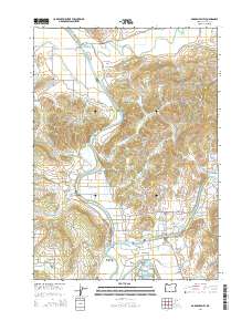
2014 Map of Garden Valley
USGS Topo · Published 2014About this map
The confluence of the North Umpqua River and South Umpqua River defines this landscape, where the waters merge to form the main stem of the Umpqua River. This riverine system supported a network of small agricultural and residential hubs such as Riversdale, Cleveland, and Umpqua. The area is notably dense with small family burial grounds, providing a significant resource for genealogical research. Locations like the La Brie Family Cemeteries, Archambeau Family Cem, and Champagne Family Cem are documented alongside established community sites like the Coles Valley Cem. Higher ground is marked by Red Hill and Coyote Hill, while the Champagne Creek Valley and the Hidden Valley Reservoir illustrate the diverse local topography. The transport network, including Browns Bridge and roads like Garden Valley Rd and Fort McKay Rd, connects these valley floor settlements through the winding river corridor.
Find a feature on this map
157 named features on this map. Tap any name to fly to it.
Don’t see what you’re looking for? This feature index may not catch every label — zoom into the map to look around manually.
Map Details
Editions of this 2014 Garden Valley Map
This is the sole edition of this map. No revisions or reprints were ever made.
Other maps of this area

1897 · Roseburg
USGS Topo · 1:125,000

1900 · Roseburg
USGS Topo · 1:125,000
1928 · Sitkum
USGS Topo · 1:125,000
1954 · Sutherlin
USGS Topo · 1:62,500
1955 · Camas Valley
USGS Topo · 1:62,500
1955 · Tyee
USGS Topo · 1:62,500
1955 · Roseburg
USGS Topo · 1:62,500

1958 · Roseburg
USGS Topo · 1:250,000

1959 · Roseburg
USGS Topo · 1:250,000
1979 · Roseburg
USGS Topo · 1:100,000