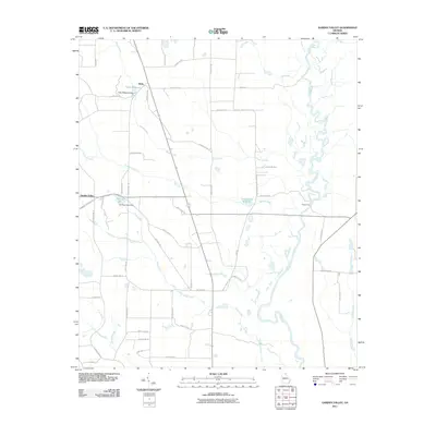
2011 Map of Garden Valley
USGS Topo · Published 2011About this map
The Flint River meanders through the eastern edge of this agricultural landscape in Macon County, defining a complex network of wetlands and tributaries. The settlement of Garden Valley serves as a western anchor for a territory shaped by historical water management, evidenced by features such as Hicks Millpond and Underwood Millpond. These millponds, along with Hartman Lake, indicate a long-standing reliance on local creek systems like Toteover Creek and Horse Creek for industry and irrigation. The presence of Miona Ferry along the river highlights a traditional crossing point that pre-dates modern bridging, while the named roads, such as General John B Gordon Rd and Miona Springs Rd, provide a map of the rural property lines and family names that have shaped the district since the early 20th century.
Find a feature on this map
54 named features on this map. Tap any name to fly to it.
Don’t see what you’re looking for? This feature index may not catch every label — zoom into the map to look around manually.
Map Details
Editions of this 2011 Garden Valley Map
This is the sole edition of this map. No revisions or reprints were ever made.
Other maps of this area

1955 · Phenix City
USGS Topo · 1:250,000

1956 · Fort Valley
USGS Topo · 1:62,500

1957 · Phenix City
USGS Topo · 1:250,000

1957 · Macon
USGS Topo · 1:250,000

1958 · Macon
USGS Topo · 1:250,000

1958 · Phenix City
USGS Topo · 1:250,000

1964 · Macon
USGS Topo · 1:250,000

1971 · Ideal South
USGS Topo · 1:24,000

1971 · Reynolds
USGS Topo · 1:24,000

1971 · Ideal North
USGS Topo · 1:24,000