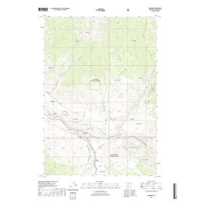
2020 Map of Gardiner
USGS Topo · Published 2020About this map
Gardiner serves as the focal point for this survey, situated at the confluence of the Yellowstone River and the Gardner River. The map captures the infrastructure supporting the northern gateway to Yellowstone National Park, including the Yellowstone River Bridge and the Gardiner Airport. Transportation routes like the Old Yellowstone Trail and the North Entrance Road follow the natural contours of the valley, while the Old Gardiner Road provides historical context for how visitors once navigated this terrain. To the north, the Gallatin National Forest contains significant elevation shifts near Sheep Mtn and Maiden Basin. The topography is marked by distinctive features such as Eagle Nest Rock and Gardner Canyon, alongside landmarks like Turkey Pen Peak and McMinn Bench. Local history is anchored by the Gardiner Cem, while the rugged surroundings are defined by numerous creeks like Bear Cr and Eagle Cr.
Find a feature on this map
61 named features on this map. Tap any name to fly to it.
Don’t see what you’re looking for? This feature index may not catch every label — zoom into the map to look around manually.
Map Details
Editions of this 2020 Gardiner Map
This is the sole edition of this map. No revisions or reprints were ever made.
Other maps of this area

1885 · Gallatin
USGS Topo · 1:125,000

1885 · Gallatin
USGS Topo · 1:125,000

1891 · Livingston
USGS Topo · 1:250,000

1893 · Livingston
USGS Topo · 1:250,000

1901 · Gallatin
USGS Topo · 1:125,000

1908 · Gallatin
USGS Topo · 1:125,000

1911 · Gallatin
USGS Topo · 1:125,000

1947 · Bozeman
USGS Topo · 1:250,000

1948 · Bozeman
USGS Topo · 1:250,000

1955 · Bozeman
USGS Topo · 1:250,000