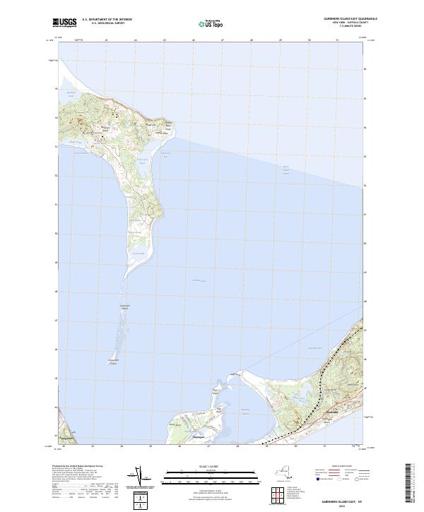
2023 Map of Gardiners Island East
USGS Topo · Published 2023About this map
Gardiners Island stands as a prominent private estate surrounded by the waters of Gardiners Bay and Block Island Sound. This landscape is defined by a series of significant coastal ponds, including Tobacolot Pond, Gales Pond, and Great Pond, which reflect the island's unique hydrography. The presence of the Gardiners Island Cem near the central manor area offers a point of interest for genealogists and local historians tracking the long-standing legacy of the estate.
Find a feature on this map
41 named features on this map. Tap any name to fly to it.
Don’t see what you’re looking for? This feature index may not catch every label — zoom into the map to look around manually.
Map Details
Editions of this 2023 Gardiners Island East Map
This is the sole edition of this map. No revisions or reprints were ever made.
Other maps of this area

1903 · Gardiners Island
USGS Topo · 1:62,500

1904 · Easthampton
USGS Topo · 1:62,500

1904 · Gardiners Island
USGS Topo · 1:62,500

1904 · Montauk
USGS Topo · 1:62,500

1921 · Gardiners Island
USGS Topo · 1:62,500

1921 · Easthampton
USGS Topo · 1:62,500
1942 · Montauk Point
USGS Topo · 1:24,000

1942 · Block Island
USGS Topo · 1:125,000

1943 · Gardiners Island East
USGS Topo · 1:24,000

1944 · Gardiners Island West
USGS Topo · 1:24,000
Featured Places
- East Hampton, NY
- Springs, East Hampton
- Montauk, East Hampton
- Amagansett, East Hampton
- Napeague, East Hampton