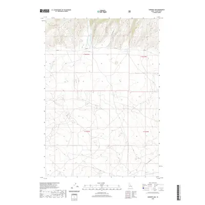
2020 Map of Gardner Lake
USGS Topo · Published 2020About this map
Gardner Lake serves as a central landmark in this high-altitude drainage basin within Clark County. The landscape is defined by a dendritic network of mountain streams, including W Fork Rattlesnake Cr and E Fork Rattlesnake Cr, which converge as they flow toward the south and west. This 2020 survey illustrates the remote character of the region, where human impact is primarily limited to a sparse grid of access ways like Idmon Rd and Corral Creek Rd. The terrain is marked by significant elevation changes, with Spring Cr navigating the undulating slopes between the mountain forks. The presence of the A-Z Clark Co Rd in the southern portion suggests the primary route for reaching this isolated part of the Idaho backcountry.
Find a feature on this map
12 named features on this map. Tap any name to fly to it.
Don’t see what you’re looking for? This feature index may not catch every label — zoom into the map to look around manually.
Map Details
Editions of this 2020 Gardner Lake Map
This is the sole edition of this map. No revisions or reprints were ever made.
Other maps of this area

1955 · Dubois
USGS Topo · 1:250,000

1955 · Ashton
USGS Topo · 1:250,000

1958 · Dubois
USGS Topo · 1:250,000

1958 · Ashton
USGS Topo · 1:250,000

1960 · Ashton
USGS Topo · 1:250,000

1964 · Dubois NW
USGS Topo · 1:24,000

1964 · Dubois NE
USGS Topo · 1:24,000

1972 · Spencer South
USGS Topo · 1:24,000

1972 · Kilgore
USGS Topo · 1:24,000

1972 · Spencer North
USGS Topo · 1:24,000