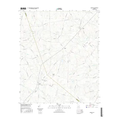
2017 Map of Garfield
USGS Topo · Published 2017About this map
Garfield serves as the central hub of this agricultural landscape in Emanuel County, Georgia, where the local road network radiates toward neighboring Thrift and Butts. The terrain is deeply intertwined with the drainage basins of Fifteenmile Cr and Sculls Cr, creating a pattern of wetlands and branches such as Wildcat Br and Sand Hill Br. This 2017 survey documents the enduring community infrastructure of the region, from the Hebron Ch and its associated Hebron Cem to the Union Chapel Cem further south.
Find a feature on this map
88 named features on this map. Tap any name to fly to it.
Don’t see what you’re looking for? This feature index may not catch every label — zoom into the map to look around manually.
Map Details
Editions of this 2017 Garfield Map
This is the sole edition of this map. No revisions or reprints were ever made.
Other maps of this area

1920 · Millen
USGS Topo · 1:62,500

1921 · Rocky Ford
USGS Topo · 1:62,500

1943 · Rocky Ford
USGS Topo · 1:62,500

1943 · Millen
USGS Topo · 1:62,500

1943 · Millen
USGS Topo · 1:125,000

1947 · Savannah
USGS Topo · 1:250,000

1948 · Savannah
USGS Topo · 1:250,000

1957 · Macon
USGS Topo · 1:250,000

1957 · Savannah
USGS Topo · 1:250,000

1958 · Macon
USGS Topo · 1:250,000