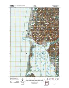
2011 Map of Garibaldi
USGS Topo · Published 2011About this map
Tillamook Bay dominates this coastal landscape, where the shifting sands of the Bayocean Peninsula separate the Pacific from the intricate channels of the harbor. Along the northern shoreline, the resort community of Rockaway Beach and the iconic Twin Rocks Arch define the oceanfront, while the Miami River feeds into the bay near Garibaldi. This 2011 survey captures the area's established maritime and recreational infrastructure, from the Port of Bay City Boat Moorage to the secluded grounds of Camp Magruder.
Find a feature on this map
74 named features on this map. Tap any name to fly to it.
Don’t see what you’re looking for? This feature index may not catch every label — zoom into the map to look around manually.
Map Details
Editions of this 2011 Garibaldi Map
This is the sole edition of this map. No revisions or reprints were ever made.
Other maps of this area

1937 · Nehalem
USGS Topo · 1:62,500

1942 · Tillamook
USGS Topo · 1:62,500

1943 · Nehalem
USGS Topo · 1:62,500

1948 · Vancouver
USGS Topo · 1:250,000

1950 · Vancouver
USGS Topo · 1:250,000

1950 · Vancouver
USGS Topo · 1:250,000

1955 · Nehalem
USGS Topo · 1:62,500

1955 · Tillamook
USGS Topo · 1:62,500

1958 · Vancouver
USGS Topo · 1:250,000

1964 · Vancouver
USGS Topo · 1:250,000