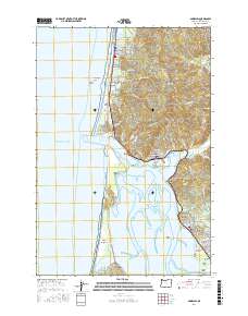
2017 Map of Garibaldi
USGS Topo · Published 2017About this map
Rockaway Beach and the coastal communities of northern Tillamook County are defined by their position between the Pacific shoreline and the steep coastal mountains. This survey illustrates the intricate relationship between the region's diverse water bodies, from the freshwater of Lake Lytle and Seaview Lake to the protected waters of Tillamook Bay. The landscape is dominated by the prominent Bayocean Peninsula, which separates the bay from the ocean, and the rocky heights of Captain Gray Mtn to the east.
Find a feature on this map
94 named features on this map. Tap any name to fly to it.
Don’t see what you’re looking for? This feature index may not catch every label — zoom into the map to look around manually.
Map Details
Editions of this 2017 Garibaldi Map
This is the sole edition of this map. No revisions or reprints were ever made.
Other maps of this area

1937 · Nehalem
USGS Topo · 1:62,500

1942 · Tillamook
USGS Topo · 1:62,500

1943 · Nehalem
USGS Topo · 1:62,500

1948 · Vancouver
USGS Topo · 1:250,000

1950 · Vancouver
USGS Topo · 1:250,000

1950 · Vancouver
USGS Topo · 1:250,000

1955 · Nehalem
USGS Topo · 1:62,500

1955 · Tillamook
USGS Topo · 1:62,500

1958 · Vancouver
USGS Topo · 1:250,000

1964 · Vancouver
USGS Topo · 1:250,000