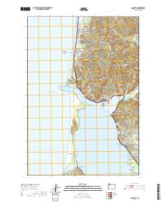
2020 Map of Garibaldi
USGS Topo · Published 2020About this map
Tillamook Bay and its sheltered northeastern shoreline anchor this study of coastal Oregon’s geography. The coastline is defined by the narrow Bayocean Peninsula, which separates the bay from the Pacific Ocean and terminates at Kincheloe Point. This barrier landscape, along with nearby Cape Meares and the Sibley Sands, reveals the dynamic nature of the region's estuarine environment. Further north, the coastal towns of Rockaway Beach and Twin Rocks are characterized by prominent offshore features like the Twin Rocks Arch and Painted Rock. Inland, the terrain rises toward Captain Gray Mtn, where numerous small drainages like Heitmiller Cr and Watseco Cr flow toward the sea. The map documents the residential and industrial footprints of Garibaldi and Bay City, highlighting the relationship between these communities and the Miami River delta.
Find a feature on this map
98 named features on this map. Tap any name to fly to it.
Don’t see what you’re looking for? This feature index may not catch every label — zoom into the map to look around manually.
Map Details
Editions of this 2020 Garibaldi Map
This is the sole edition of this map. No revisions or reprints were ever made.
Other maps of this area

1937 · Nehalem
USGS Topo · 1:62,500

1942 · Tillamook
USGS Topo · 1:62,500

1943 · Nehalem
USGS Topo · 1:62,500

1948 · Vancouver
USGS Topo · 1:250,000

1950 · Vancouver
USGS Topo · 1:250,000

1950 · Vancouver
USGS Topo · 1:250,000

1955 · Nehalem
USGS Topo · 1:62,500

1955 · Tillamook
USGS Topo · 1:62,500

1958 · Vancouver
USGS Topo · 1:250,000

1964 · Vancouver
USGS Topo · 1:250,000