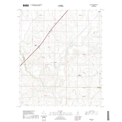
2018 Map of Garland
USGS Topo · Published 2018About this map
The Sepulga River winds through the southern reaches of this landscape, marking the transition between Butler and Conecuh counties. The settlement of Garland serves as a central point for a network of rural roads, including the notable Hank Williams Rd, which cuts across the terrain toward Mount Olive. This area is characterized by numerous family and community burial grounds, such as Maye Cem, Pressley Cem, and McClure Cem, which provide significant touchpoints for genealogical research in the region.
Find a feature on this map
50 named features on this map. Tap any name to fly to it.
Don’t see what you’re looking for? This feature index may not catch every label — zoom into the map to look around manually.
Map Details
Editions of this 2018 Garland Map
This is the sole edition of this map. No revisions or reprints were ever made.
Other maps of this area

1953 · Andalusia
USGS Topo · 1:250,000

1957 · Andalusia
USGS Topo · 1:250,000

1971 · Lyeffion
USGS Topo · 1:24,000

1971 · Brooks
USGS Topo · 1:24,000

1971 · Mc Kenzie
USGS Topo · 1:24,000

1971 · Georgiana East
USGS Topo · 1:24,000

1971 · Garland
USGS Topo · 1:24,000

1971 · Bethel
USGS Topo · 1:24,000

1971 · Georgiana West
USGS Topo · 1:24,000

1982 · Evergreen
USGS Topo · 1:24,000