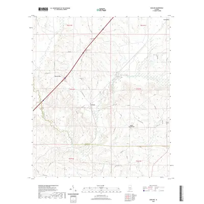
2020 Map of Garland
USGS Topo · Published 2020About this map
Garland and Georgiana anchor this landscape along the Butler and Conecuh county line, where the rural terrain is defined by the drainage of the Sepulga River and its many tributaries. The area is characterized by a high density of family and community burial grounds, including Sellers Cem, Garland Cem, and the McClure Cem, which serve as vital markers for local genealogical research. In the northwestern quadrant, Hank Williams Rd cuts through Mount Olive, while to the east, the waters of Persimmon Creek and Lake Alexander shape the low-lying geography. The road network connects small hubs like Odom Crossroads via routes such as Mill Creek Rd and Co Rd 8, reflecting a settlement pattern that remains focused on these traditional intersections and the agricultural land surrounding them.
Find a feature on this map
50 named features on this map. Tap any name to fly to it.
Don’t see what you’re looking for? This feature index may not catch every label — zoom into the map to look around manually.
Map Details
Editions of this 2020 Garland Map
This is the sole edition of this map. No revisions or reprints were ever made.
Other maps of this area

1953 · Andalusia
USGS Topo · 1:250,000

1957 · Andalusia
USGS Topo · 1:250,000

1971 · Lyeffion
USGS Topo · 1:24,000

1971 · Brooks
USGS Topo · 1:24,000

1971 · Mc Kenzie
USGS Topo · 1:24,000

1971 · Georgiana East
USGS Topo · 1:24,000

1971 · Garland
USGS Topo · 1:24,000

1971 · Bethel
USGS Topo · 1:24,000

1971 · Georgiana West
USGS Topo · 1:24,000

1982 · Evergreen
USGS Topo · 1:24,000