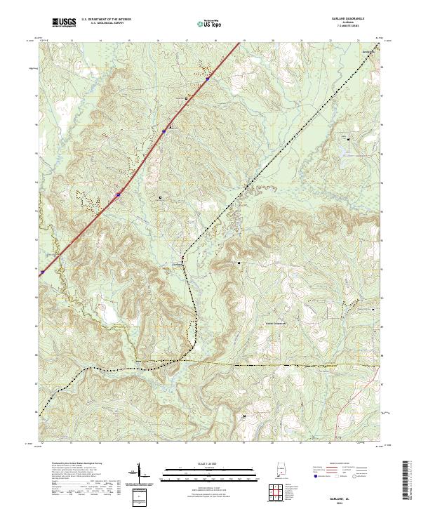
2024 Map of Garland
USGS Topo · Published 2024About this map
The Conecuh River and Sepulga River converge at the southern edge of this landscape, defining a region where water and wood have long shaped local life. The settlement of Garland sits centrally near the junction of several county roads and the Dillyhill Rd, surrounded by numerous family and community burial grounds including Maye Cem, Pressley Cem, and Garland Cem. To the east, Odom Crossroads marks a distinct junction point in the upland terrain between Persimmon Creek and Piney Woods Creek. The map reveals a high density of small cemeteries such as McClure Cem and Walker Cem, providing significant data points for genealogists tracing South Alabama families. Local landmarks like Lake Alexander and the corridor along Hank Williams Rd further ground the area's identity within Butler and Conecuh Counties.
Find a feature on this map
49 named features on this map. Tap any name to fly to it.
Don’t see what you’re looking for? This feature index may not catch every label — zoom into the map to look around manually.
Map Details
Editions of this 2024 Garland Map
This is the sole edition of this map. No revisions or reprints were ever made.
Other maps of this area

1953 · Andalusia
USGS Topo · 1:250,000

1957 · Andalusia
USGS Topo · 1:250,000

1971 · Lyeffion
USGS Topo · 1:24,000

1971 · Brooks
USGS Topo · 1:24,000

1971 · Mc Kenzie
USGS Topo · 1:24,000

1971 · Georgiana East
USGS Topo · 1:24,000

1971 · Garland
USGS Topo · 1:24,000

1971 · Bethel
USGS Topo · 1:24,000

1971 · Georgiana West
USGS Topo · 1:24,000

1982 · Evergreen
USGS Topo · 1:24,000