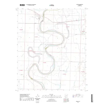
2020 Map of Garland
USGS Topo · Published 2020About this map
The Red River defines the landscape of this Arkansas-Texas borderlands region, winding in deep oxbows across the boundary between Miller and Lafayette Counties. The town of Garland occupies the northern reach of this survey, where a grid of streets including Front St and Wall St sits near the Red River Bridge. This alluvial plain is marked by the scars of previous river courses, now preserved as water bodies like the crescent-shaped Keller Lake and the long stretch of Moccasin Bayou. Local history and genealogy are anchored by small burial grounds such as Mays Cem and Wright Cem, which sit among a network of county roads and drainage features like the Field Bayou Ditch. The geography here reveals a long-standing relationship with the river's shifting path and the fertile lowlands it created.
Find a feature on this map
34 named features on this map. Tap any name to fly to it.
Don’t see what you’re looking for? This feature index may not catch every label — zoom into the map to look around manually.
Map Details
Editions of this 2020 Garland Map
This is the sole edition of this map. No revisions or reprints were ever made.
Other maps of this area

1952 · Garland
USGS Topo · 1:24,000

1952 · Fouke SE
USGS Topo · 1:24,000

1952 · Bradley NE
USGS Topo · 1:24,000

1952 · Old Town
USGS Topo · 1:24,000

1952 · Doddridge NE
USGS Topo · 1:24,000

1952 · Canfield
USGS Topo · 1:24,000

1952 · Lewisville
USGS Topo · 1:24,000

1952 · Fouke NE
USGS Topo · 1:24,000

1952 · Boyd Hill
USGS Topo · 1:24,000

1953 · El Dorado
USGS Topo · 1:250,000