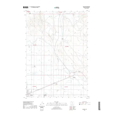
2017 Map of Garland
USGS Topo · Published 2017About this map
Irrigated agriculture in the Shoshone River valley defines this northern Wyoming landscape, where an intricate network of waterways like the Garland Canal and Frannie Canal transformed the arid terrain of the Big Horn Basin. The town of Powell anchors the southwest corner of the sheet, surrounded by the smaller settlements of Garland and Mantua. This 2017 survey illustrates how the grid of local roads, such as Desert Rd and Rd 7, follows the township and range lines established by early surveyors. To the north, the elevation rises toward Polecat Bench, while historical movement through the region is marked by the Jim Bridger Trl. Local heritage sites, including Crown Hill Cem and the Garland Cem, serve as important landmarks for genealogists and local historians tracking the families that settled this farming frontier.
Find a feature on this map
57 named features on this map. Tap any name to fly to it.
Don’t see what you’re looking for? This feature index may not catch every label — zoom into the map to look around manually.
Map Details
Editions of this 2017 Garland Map
This is the sole edition of this map. No revisions or reprints were ever made.
Other maps of this area

1955 · Cody
USGS Topo · 1:250,000

1958 · Cody
USGS Topo · 1:250,000

1962 · Cody
USGS Topo · 1:250,000

1966 · Gilmore Hill NE
USGS Topo · 1:24,000

1966 · Frannie
USGS Topo · 1:24,000

1966 · Garland
USGS Topo · 1:24,000

1966 · Elk Basin
USGS Topo · 1:24,000

1966 · Deaver Reservoir
USGS Topo · 1:24,000

1966 · Elk Basin SE
USGS Topo · 1:24,000

1966 · Gilmore Hill NW
USGS Topo · 1:24,000