
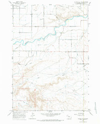
1966 Map of Gilmore Hill NW
USGS Topo · Published 1970About this map
The Shoshone River winds through this section of Park County, carving a distinct valley between the irrigated agricultural lands of Powell Flats and the broken terrain of Roan Wash to the south. This mid-1960s landscape is defined by an intricate network of water management, including the Elk Lovell Canal, Willwood Canal, and various laterals that transformed the high desert into productive acreage. These engineering efforts are further evidenced by a prominent Aqueduct and numerous ditches following the local topography.
Find a feature on this map
32 named features on this map. Tap any name to fly to it.
Don’t see what you’re looking for? This feature index may not catch every label — zoom into the map to look around manually.
Map Details
Editions of this 1966 Gilmore Hill NW Map
2 editions found
Other maps of this area

1955 · Cody
USGS Topo · 1:250,000

1958 · Cody
USGS Topo · 1:250,000

1962 · Cody
USGS Topo · 1:250,000

1966 · Gilmore Hill NE
USGS Topo · 1:24,000

1966 · Gilmore Hill SE
USGS Topo · 1:24,000

1966 · Stone Barn Camp
USGS Topo · 1:24,000

1966 · Garland
USGS Topo · 1:24,000

1966 · Elk Basin SE
USGS Topo · 1:24,000

1966 · Gilmore Hill
USGS Topo · 1:24,000
1967 · Byron
USGS Topo · 1:24,000