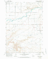
1966 Map of Gilmore Hill NW
USGS Topo · Published 1984About this map
Shoshone River meanders across this mid-1960s landscape, serving as the lifeblood for an extensive network of irrigation infrastructure north of the Roan Wash badlands. The map reveals a complex water management system designed to transform the high desert of Powell Flats, featuring the Willwood Canal, Elk Lovell Canal, and the Willwood Aqueduct. This irrigation network supports a grid of agricultural development defined by numbered roads and lanes, such as Road Eight and Lane Ten.
Find a feature on this map
28 named features on this map. Tap any name to fly to it.
Don’t see what you’re looking for? This feature index may not catch every label — zoom into the map to look around manually.
Map Details
Editions of this 1966 Gilmore Hill NW Map
2 editions found
Other maps of this area

1955 · Cody
USGS Topo · 1:250,000

1958 · Cody
USGS Topo · 1:250,000

1962 · Cody
USGS Topo · 1:250,000

1966 · Gilmore Hill NE
USGS Topo · 1:24,000

1966 · Gilmore Hill SE
USGS Topo · 1:24,000

1966 · Stone Barn Camp
USGS Topo · 1:24,000

1966 · Garland
USGS Topo · 1:24,000

1966 · Elk Basin SE
USGS Topo · 1:24,000

1966 · Gilmore Hill NW
USGS Topo · 1:24,000

1966 · Gilmore Hill
USGS Topo · 1:24,000