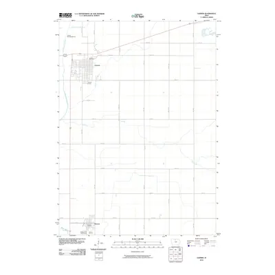
2010 Map of Garner
USGS Topo · Published 2010About this map
Garner and Klemme anchor this agricultural landscape in north-central Iowa, where the rectilinear grid of county roads is punctuated by several drainage projects and the wandering course of the East Branch Iowa River. The terrain is defined by a sophisticated water management system, including Drainage Ditch Number 13, Drainage Ditch Number 81, and Drainage Ditch Number 9, which support the intensive farming characteristic of Hancock County. To the north, the Garner Municipal Airport and Concord Cemetery mark the outskirts of the town, while the southern portion of the map shows Klemme situated near the E Br Iowa R and the Slippery Elm Golf Course. This survey preserves the exact location of local institutions like the Garner Post Office and Klemme Post Office, providing a clear view of these communities at the turn of the decade.
Find a feature on this map
29 named features on this map. Tap any name to fly to it.
Don’t see what you’re looking for? This feature index may not catch every label — zoom into the map to look around manually.
Map Details
Editions of this 2010 Garner Map
This is the sole edition of this map. No revisions or reprints were ever made.
Other maps of this area

1954 · Mason City
USGS Topo · 1:250,000

1954 · Waterloo
USGS Topo · 1:250,000

1955 · Waterloo
USGS Topo · 1:250,000

1957 · Mason City
USGS Topo · 1:250,000

1958 · Mason City
USGS Topo · 1:250,000

1972 · Clear Lake West
USGS Topo · 1:24,000

1972 · Thornton
USGS Topo · 1:24,000

1972 · Hayfield
USGS Topo · 1:24,000

1972 · Olaf
USGS Topo · 1:24,000
1972 · Ventura Heights
USGS Topo · 1:24,000