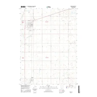
2015 Map of Garner
USGS Topo · Published 2015About this map
Garner and Klemme anchor this agricultural landscape in north-central Iowa, where the rectilinear grid of township roads and section lines dictates the movement of people and water. The town of Garner is mapped in detail, showing a network of residential streets including Allen Ave, Bush Ave, and Cottonwood Dr alongside the northern boundary of Concord Cem. To the south, Klemme sits near Calvary Cem, marking a distinct pocket of settlement amidst the vast surrounding acreage.
Find a feature on this map
56 named features on this map. Tap any name to fly to it.
Don’t see what you’re looking for? This feature index may not catch every label — zoom into the map to look around manually.
Map Details
Editions of this 2015 Garner Map
This is the sole edition of this map. No revisions or reprints were ever made.
Other maps of this area

1954 · Mason City
USGS Topo · 1:250,000

1954 · Waterloo
USGS Topo · 1:250,000

1955 · Waterloo
USGS Topo · 1:250,000

1957 · Mason City
USGS Topo · 1:250,000

1958 · Mason City
USGS Topo · 1:250,000

1972 · Clear Lake West
USGS Topo · 1:24,000

1972 · Thornton
USGS Topo · 1:24,000

1972 · Hayfield
USGS Topo · 1:24,000

1972 · Olaf
USGS Topo · 1:24,000
1972 · Ventura Heights
USGS Topo · 1:24,000