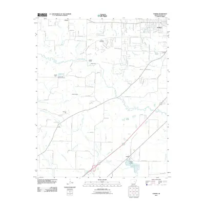
2011 Map of Garner
USGS Topo · Published 2011About this map
Bayou Des Arc meanders across this White County landscape, defining a region characterized by a complex network of wetlands and minor ridges south of Searcy. The terrain is marked by distinctive local landmarks like Honey Hill Ridge and Peanut Ridge, which rise above the surrounding bottomlands and sloughs. Water management is a primary feature of the local geography, seen in the infrastructure of Lercher Lake Number One Dam and the southern Schroeder Lake Two Dam.
Find a feature on this map
114 named features on this map. Tap any name to fly to it.
Don’t see what you’re looking for? This feature index may not catch every label — zoom into the map to look around manually.
Map Details
Editions of this 2011 Garner Map
This is the sole edition of this map. No revisions or reprints were ever made.
Other maps of this area

1932 · Kensett
USGS Topo · 1:62,500

1935 · Kensett
USGS Topo · 1:62,500

1935 · Bald Knob
USGS Topo · 1:62,500

1953 · Memphis
USGS Topo · 1:250,000

1956 · Memphis
USGS Topo · 1:250,000

1962 · Letona
USGS Topo · 1:24,000

1963 · Garner
USGS Topo · 1:24,000

1963 · Floyd
USGS Topo · 1:24,000

1963 · Sidon
USGS Topo · 1:24,000
1963 · Beebe
USGS Topo · 1:24,000