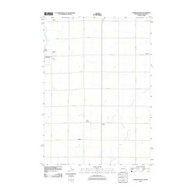
2010 Map of Garretson East
USGS Topo · Published 2010About this map
Garretson and the surrounding prairie of Minnehaha County are defined by a rhythmic grid of section-line roads and scattered pioneer burial grounds. This landscape near the South Dakota and Minnesota border highlights the community's early social infrastructure, with no fewer than six named cemeteries—including Sherman Cemetery, Zion Cemetery, and Palisades Cemetery—placed methodically across the townships. The geometric order of 486th Ave and County Hwy-20 is interrupted only by the winding paths of Split Rock Creek and Springwater Creek. In the northwest, the distinctive terrain of Devils Gulch provides a rare break in the agricultural plains, while the small settlement of Booge serves as a localized landmark in the southern reaches of the quadrangle. The map reveals how local transit remains anchored to established county highways like County Hwy-14, which facilitate movement between these rural homesteads and township centers.
Find a feature on this map
28 named features on this map. Tap any name to fly to it.
Don’t see what you’re looking for? This feature index may not catch every label — zoom into the map to look around manually.
Map Details
Editions of this 2010 Garretson East Map
This is the sole edition of this map. No revisions or reprints were ever made.
Other maps of this area

1955 · Sioux Falls
USGS Topo · 1:250,000

1958 · Sioux Falls
USGS Topo · 1:250,000

1962 · Brandon
USGS Topo · 1:24,000

1962 · Garretson West
USGS Topo · 1:24,000

1967 · Valley Springs
USGS Topo · 1:24,000

1967 · Garretson East
USGS Topo · 1:24,000

1967 · Hills
USGS Topo · 1:24,000

1967 · Jasper SE
USGS Topo · 1:24,000

1967 · Hills NE
USGS Topo · 1:24,000

1967 · Jasper
USGS Topo · 1:24,000
Featured Places
- Garretson, SD
- Palisade Township, SD
- Beaver Creek Township, MN
- Springwater Township, MN
- Red Rock Township, SD