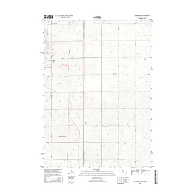
2015 Map of Garretson East
USGS Topo · Published 2015About this map
Garretson stands as the primary hub in this borderland landscape where Minnehaha County, South Dakota, meets Minnesota. The geography is defined by the Coteau des Prairies upland, with Split Rock Creek carving through the terrain near the distinctive Devils Gulch. This 2015 survey reveals a deeply rooted rural community, evidenced by a high density of local burial sites such as Saint Rose Cem, Zion Cem, and West Palisades Cem. To the south, the small settlement of Booge sits along the section lines, while Springwater Cr and Annie Anderson Cr drain the eastern slopes of the plateau. The map details a rigid grid of township roads, including 486th Ave and 111th St, which organize the agricultural life of the region.
Find a feature on this map
44 named features on this map. Tap any name to fly to it.
Don’t see what you’re looking for? This feature index may not catch every label — zoom into the map to look around manually.
Map Details
Editions of this 2015 Garretson East Map
This is the sole edition of this map. No revisions or reprints were ever made.
Other maps of this area

1955 · Sioux Falls
USGS Topo · 1:250,000

1958 · Sioux Falls
USGS Topo · 1:250,000

1962 · Brandon
USGS Topo · 1:24,000

1962 · Garretson West
USGS Topo · 1:24,000

1967 · Valley Springs
USGS Topo · 1:24,000

1967 · Garretson East
USGS Topo · 1:24,000

1967 · Hills
USGS Topo · 1:24,000

1967 · Jasper SE
USGS Topo · 1:24,000

1967 · Hills NE
USGS Topo · 1:24,000

1967 · Jasper
USGS Topo · 1:24,000
Featured Places
- Garretson, SD
- Palisade Township, SD
- Beaver Creek Township, MN
- Springwater Township, MN
- Red Rock Township, SD