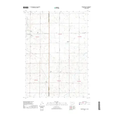
2017 Map of Garretson East
USGS Topo · Published 2017About this map
Devils Gulch and the surrounding prairie landscape define this borderlands region where Minnehaha County meets Rock County at the South Dakota-Minnesota line. The 2017 survey reveals a highly organized township structure of section lines and rural roads, with the town of Garretson serving as the primary hub in the northwest corner. This area sits upon the Coteau des Prairies, a vast upland plateau that influences the local drainage patterns. Tributaries like Split Rock Creek and Annie Anderson Cr carve through the terrain, while the rural landscape is dotted with small-scale religious and burial sites. Genealogists can find several distinct locations such as West Palisades Cem, Palisades Cem, and Zion Lutheran Church Cem, reflecting the early settlement patterns of the township. In the south, the community of Booge remains a named point of interest along the established county road network.
Find a feature on this map
54 named features on this map. Tap any name to fly to it.
Don’t see what you’re looking for? This feature index may not catch every label — zoom into the map to look around manually.
Map Details
Editions of this 2017 Garretson East Map
This is the sole edition of this map. No revisions or reprints were ever made.
Other maps of this area

1955 · Sioux Falls
USGS Topo · 1:250,000

1958 · Sioux Falls
USGS Topo · 1:250,000

1962 · Brandon
USGS Topo · 1:24,000

1962 · Garretson West
USGS Topo · 1:24,000

1967 · Valley Springs
USGS Topo · 1:24,000

1967 · Garretson East
USGS Topo · 1:24,000

1967 · Hills
USGS Topo · 1:24,000

1967 · Jasper SE
USGS Topo · 1:24,000

1967 · Hills NE
USGS Topo · 1:24,000

1967 · Jasper
USGS Topo · 1:24,000
Featured Places
- Garretson, SD
- Palisade Township, SD
- Beaver Creek Township, MN
- Springwater Township, MN
- Red Rock Township, SD