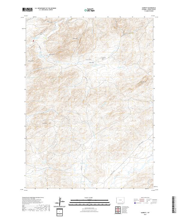
2021 Map of Garrett
USGS Topo · Published 2021About this map
The settlement of Garrett sits at the northern edge of this high-altitude landscape where the N Laramie River winds through rugged gulches. Water management is a defining characteristic of this terrain, evidenced by a series of high-desert water storage sites including Sturgeon Number 3 Reservoir, Sturgeon Reservoir Number 1, and Sturgeon Reservoir Number 2. The landscape rises sharply at Sellers Mtn and Brandel Mtn, while the southwestern corner is marked by the distinctive Pinto Rocks. This 2021 survey illustrates a region largely defined by vast drainage systems like Wildcat Gulch and Fallas Draw, supporting a network of ranching roads such as Palmer Canyon Rd and River Bridge Rd. It reveals a transition from seasonal creek beds to permanent springs like Asbestos Spring, essential for land use in this part of Albany County.
Find a feature on this map
40 named features on this map. Tap any name to fly to it.
Don’t see what you’re looking for? This feature index may not catch every label — zoom into the map to look around manually.
Map Details
Editions of this 2021 Garrett Map
This is the sole edition of this map. No revisions or reprints were ever made.
Other maps of this area

1954 · Torrington
USGS Topo · 1:250,000

1954 · Cheyenne
USGS Topo · 1:250,000

1955 · Dodge Ranch
USGS Topo · 1:24,000

1955 · Ayres Spring
USGS Topo · 1:24,000

1955 · Bull Camp Peak
USGS Topo · 1:24,000

1958 · Cheyenne
USGS Topo · 1:250,000

1958 · Torrington
USGS Topo · 1:250,000

1968 · Cow Creek Mountain
USGS Topo · 1:24,000

1968 · Davidson Flats
USGS Topo · 1:24,000

1968 · Cottonwood Creek
USGS Topo · 1:24,000