
1968 Map of Cow Creek Mountain
USGS Topo · Published 1972About this map
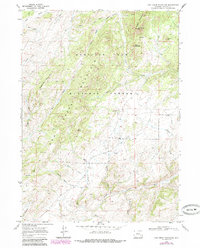
The high-country terrain of Medicine Bow National Forest dominates this Albany County landscape, defined by a series of prominent peaks and complex drainage networks. Elevations rise to landmarks such as Sugarloaf Mountain, Jack Squirrel Peak, and Indian Peak, while the southeastern corner is marked by the winding course of the North Laramie River. The map illustrates a rugged, sparsely populated region where early water rights and grazing boundaries were dictated by features like Cow Creek, Muddy Creek, and West Prong.
Find a feature on this map
34 named features on this map. Tap any name to fly to it.
Don’t see what you’re looking for? This feature index may not catch every label — zoom into the map to look around manually.
Map Details
Editions of this 1968 Cow Creek Mountain Map
2 editions found
Other maps of this area

1943 · Esterbrook
USGS Topo · 1:62,500

1945 · Esterbrook
USGS Topo · 1:62,500

1954 · Torrington
USGS Topo · 1:250,000

1958 · Torrington
USGS Topo · 1:250,000

1964 · Toltec
USGS Topo · 1:24,000

1964 · Windy Peak
USGS Topo · 1:24,000

1968 · Davidson Flats
USGS Topo · 1:24,000

1968 · Cottonwood Creek
USGS Topo · 1:24,000
1968 · South Mountain
USGS Topo · 1:24,000
1968 · Garrett
USGS Topo · 1:24,000