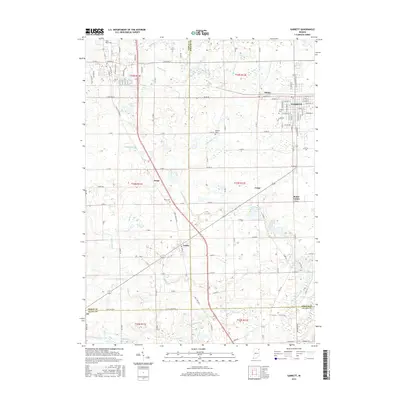
2016 Map of Garrett
USGS Topo · Published 2016About this map
Garrett and its immediate surroundings at Altona define the northern portion of this landscape, where a dense grid of streets including W King St and E Keyser St meets the open agricultural land of DeKalb County. The map documents a complex network of water management features, such as Yarde Ditch, Bilger Ditch, and Hinkley Ditch, which drain the low-lying terrain into larger channels like Little Cedar Cr. These drainage systems illustrate the historical transformation of the region's wetlands into productive farmland.
Find a feature on this map
66 named features on this map. Tap any name to fly to it.
Don’t see what you’re looking for? This feature index may not catch every label — zoom into the map to look around manually.
Map Details
Editions of this 2016 Garrett Map
This is the sole edition of this map. No revisions or reprints were ever made.
Other maps of this area

1953 · Fort Wayne
USGS Topo · 1:250,000

1955 · Corunna
USGS Topo · 1:24,000

1955 · Ege
USGS Topo · 1:24,000

1955 · Kendallville
USGS Topo · 1:24,000

1956 · Fort Wayne
USGS Topo · 1:250,000

1956 · Cedarville
USGS Topo · 1:24,000

1957 · Auburn
USGS Topo · 1:24,000

1957 · Waterloo
USGS Topo · 1:24,000

1957 · Huntertown
USGS Topo · 1:24,000

1957 · Garrett
USGS Topo · 1:24,000