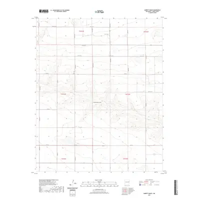
2020 Map of Garrett Ranch
USGS Topo · Published 2020About this map
Garrett Ranch sits in the high plains of eastern New Mexico, marking a landscape defined by expansive ranching and the topographic subtle variations of the Llano Estacado. The most prominent natural feature is Running Water Draw, an ephemeral drainage that winds across the central portion of the quadrangle. This intermittent waterway provides a rare break in the flat terrain, influencing the local hydrology and the placement of nearby agricultural infrastructure. The area is gridded by an extensive network of county roads, including Curry Road 25 and Curry Road 21, which follow the section lines of the Public Land Survey System. These roads serve as the primary lifelines for the isolated ranching operations and farmsteads scattered throughout Curry County, reflecting a modern continuation of early twentieth-century land division patterns.
Find a feature on this map
26 named features on this map. Tap any name to fly to it.
Don’t see what you’re looking for? This feature index may not catch every label — zoom into the map to look around manually.
Map Details
Editions of this 2020 Garrett Ranch Map
This is the sole edition of this map. No revisions or reprints were ever made.
Other maps of this area

1954 · Clovis
USGS Topo · 1:250,000

1957 · Portair
USGS Topo · 1:62,500

1957 · Clovis
USGS Topo · 1:62,500

1957 · Pleasant Hill
USGS Topo · 1:62,500

1957 · Hammond Ranch
USGS Topo · 1:62,500

1958 · Clovis
USGS Topo · 1:250,000

1985 · Portair
USGS Topo · 1:24,000

1985 · Pleasant Hill NW
USGS Topo · 1:24,000

1985 · Smith Ranch
USGS Topo · 1:24,000
1985 · Garrett Ranch
USGS Topo · 1:24,000