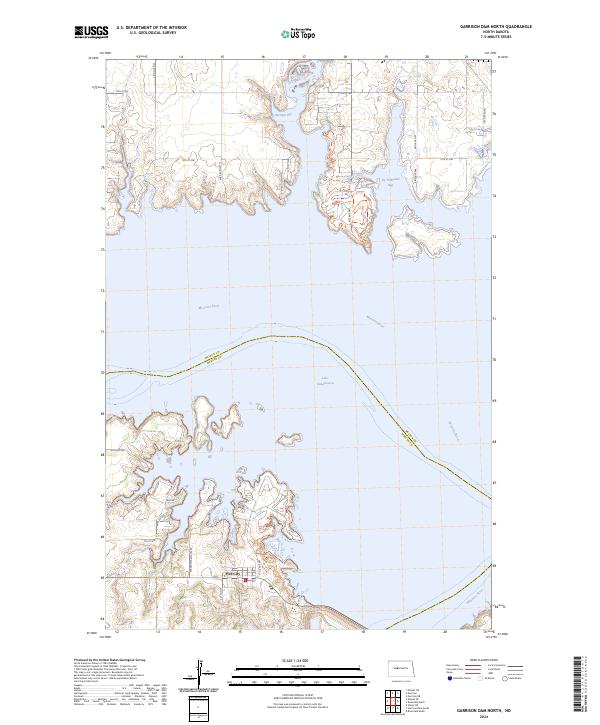
2024 Map of Garrison Dam North
USGS Topo · Published 2024About this map
Lake Sakakawea and the winding course of the Missouri River dominate this modern survey of the North Dakota landscape. The map centers on the northern reach of the Pick City settlement, where the high-water line of the reservoir creates complex shorelines at Garrison Bay and De Trobriand Bay. The topography reveals the dramatic elevation changes between the river valley and the surrounding plains of the Missouri Coteau. Local development is concentrated in the southern portion of the sheet near the Mercer Co line, specifically along residential corridors such as Sakakwea Estates Rd and Apache Loop. This 2024 data represents the current state of the regional hydrography and infrastructure, detailing the intersections of rural routes like 14th St NW and 40th Ave NW as they navigate the finger-like inlets of the bay system.
Find a feature on this map
29 named features on this map. Tap any name to fly to it.
Don’t see what you’re looking for? This feature index may not catch every label — zoom into the map to look around manually.
Map Details
Editions of this 2024 Garrison Dam North Map
This is the sole edition of this map. No revisions or reprints were ever made.
Other maps of this area

1922 · Garrison
USGS Topo · 1:62,500

1948 · Stanton
USGS Topo · 1:62,500

1949 · Stanton
USGS Topo · 1:62,500

1954 · McClusky
USGS Topo · 1:250,000

1956 · Emmet NE
USGS Topo · 1:24,000

1958 · McClusky
USGS Topo · 1:250,000

1967 · Emmet SE
USGS Topo · 1:24,000

1969 · Hazen NE
USGS Topo · 1:24,000
1969 · Garrison Dam South
USGS Topo · 1:24,000
1972 · Garrison Dam North
USGS Topo · 1:24,000