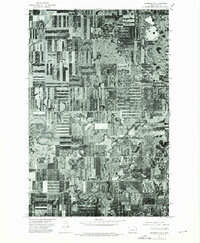
1974 Map of Garrison NW
USGS Topo · Published 1975About this map
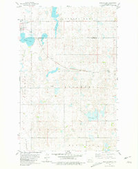
Garrison stands as the primary hub of this North Dakota landscape, shown here in a mid-1970s orthophotograph that reveals the intricate patterns of prairie agriculture. The map provides a literal photographic record of the town’s layout, showing the residential grid and grain handling facilities at a time when the region's economy was deeply tied to the surrounding wheat fields. To the south, the massive expanse of Lake Sakakawea dominates the lower margin, its rugged shoreline and backwaters indicating the significant impact of the Garrison Dam project on the local geography. The contrast between the stark, geometric lines of the section-line roads and the organic, winding coulees leading toward the reservoir captures the transition from high-plains farming to the managed waters of the Missouri River system.
Find a feature on this map
2 named features on this map. Tap any name to fly to it.
Don’t see what you’re looking for? This feature index may not catch every label — zoom into the map to look around manually.
Map Details
Editions of this 1974 Garrison NW Map
This is the sole edition of this map. No revisions or reprints were ever made.
Other maps of this area

1922 · Garrison
USGS Topo · 1:62,500

1954 · McClusky
USGS Topo · 1:250,000

1956 · Emmet NE
USGS Topo · 1:24,000

1956 · Douglas West
USGS Topo · 1:24,000

1958 · McClusky
USGS Topo · 1:250,000

1967 · Emmet SE
USGS Topo · 1:24,000
1972 · Garrison Dam North
USGS Topo · 1:24,000
1972 · Riverdale North
USGS Topo · 1:24,000
1974 · Garrison NE
USGS Topo · 1:24,000
1980 · Douglas East
USGS Topo · 1:24,000