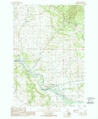
1989 Map of Garrison
USGS Topo · Published 1989About this map
Garrison serves as a critical valley junction in the late 1980s, situated where the Little Blackfoot River meets the Clark Fork. This survey captures the complex infrastructure required to navigate the mountain terrain, showing a network of tunnels, a pipeline, and high-voltage transmission lines traversing the heights. The industrial footprint of the era is evident in the numerous adits and mine workings scattered across the northern slopes near Bear Gulch and Springs Creek.
Find a feature on this map
21 named features on this map. Tap any name to fly to it.
Don’t see what you’re looking for? This feature index may not catch every label — zoom into the map to look around manually.
Map Details
Editions of this 1989 Garrison Map
This is the sole edition of this map. No revisions or reprints were ever made.
Other maps of this area

1889 · Helena
USGS Topo · 1:250,000

1893 · Helena
USGS Topo · 1:250,000

1899 · Helena
USGS Topo · 1:250,000

1903 · Helena
USGS Topo · 1:250,000

1947 · Butte
USGS Topo · 1:250,000

1958 · Butte
USGS Topo · 1:250,000

1958 · Avon
USGS Topo · 1:62,500

1958 · Garrison
USGS Topo · 1:62,500

1959 · Deer Lodge
USGS Topo · 1:62,500

1960 · Butte
USGS Topo · 1:250,000