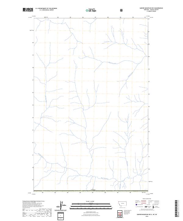
2024 Map of Garver Mountain OE N
USGS Topo · Published 2024About this map
The West Yahk River flows across the southern portion of this Lincoln County survey, serving as the primary drainage for a network of mountain tributaries. The landscape is defined by the sharp descent of several northern creeks, including Freeman Creek and Sprucetree Creek, which carve through the high terrain towards the valley floor. Positioned directly along the international boundary with Canada, the map details a remote wilderness area where physical topography and hydrological features provide the only landmarks. Small mountain streams like Brotton Creek, Hart Creek, and Screw Creek trace the narrow drainages of the Garver Mountain vicinity, illustrating the complex watershed patterns in the far northwestern reaches of Montana.
Find a feature on this map
13 named features on this map. Tap any name to fly to it.
Don’t see what you’re looking for? This feature index may not catch every label — zoom into the map to look around manually.
Map Details
Editions of this 2024 Garver Mountain OE N Map
This is the sole edition of this map. No revisions or reprints were ever made.
Other maps of this area

1957 · Kalispell
USGS Topo · 1:250,000

1960 · Kalispell
USGS Topo · 1:250,000

1961 · Kalispell
USGS Topo · 1:250,000

1963 · Northwest Peak
USGS Topo · 1:24,000

1963 · Garver Mountain
USGS Topo · 1:24,000

1963 · Bonnet Top
USGS Topo · 1:24,000

1979 · Yaak River
USGS Topo · 1:100,000
1997 · Bonnet Top
USGS Topo · 1:24,000
1997 · Garver Mountain
USGS Topo · 1:24,000
1997 · Northwest Peak
USGS Topo · 1:24,000