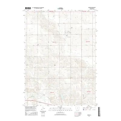
2015 Map of Garwin
USGS Topo · Published 2015About this map
Garwin sits at the center of this rural Tama County landscape, where the local economy and geography are defined by the winding paths of Deer Cr and Crystal Cr. The town's grid is anchored by Rider St and Carlton St, surrounded by an extensive network of section roads like Co Rd E27. This 2015 survey reveals a terrain deeply tied to its lineage, evidenced by a high density of small family and community burial grounds scattered across the countryside.
Find a feature on this map
38 named features on this map. Tap any name to fly to it.
Don’t see what you’re looking for? This feature index may not catch every label — zoom into the map to look around manually.
Map Details
Editions of this 2015 Garwin Map
This is the sole edition of this map. No revisions or reprints were ever made.
Other maps of this area
1954 · Waterloo
USGS Topo · 1:250,000
1954 · Des Moines
USGS Topo · 1:250,000
1955 · Waterloo
USGS Topo · 1:250,000
1956 · Des Moines
USGS Topo · 1:250,000
1957 · Des Moines
USGS Topo · 1:250,000
1960 · Marshalltown
USGS Topo · 1:62,500
1960 · Le Grand
USGS Topo · 1:24,000
1960 · Conrad East
USGS Topo · 1:24,000
1969 · Des Moines
USGS Topo · 1:250,000
1971 · Gladbrook NE
USGS Topo · 1:24,000