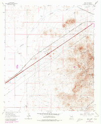
1964 Map of Gary
USGS Topo · Published 1980About this map
Mining operations in the northern Pyramid Mountains dominate this mid-century survey of the Chihuahuan Desert landscape near the Arizona border. Hard-rock mineral extraction is evidenced by a cluster of named claims including the Nellie Gray Mine, Eightyfive Mine, and Minnie Mae Mine, accompanied by specialized infrastructure like Tailings Ponds. This industrial activity contrasts with the surrounding grazing land, where water management is critical; the map identifies numerous family-named livestock wells such as Wright Windmill, Fox Windmill, and Ragsdale Windmill. The low-lying Lordsburg Flats and Tobosa grasslands transition into the alluvial fans of the Animas Valley. Transportation corridors define the region's connectivity, ranging from the historic Butterfield Trail to the heavy rail of the Southern Pacific and the development of Interstate 80.
Find a feature on this map
36 named features on this map. Tap any name to fly to it.
Don’t see what you’re looking for? This feature index may not catch every label — zoom into the map to look around manually.
Map Details
Editions of this 1964 Gary Map
2 editions found
Other maps of this area

1954 · Silver City
USGS Topo · 1:250,000

1958 · Silver City
USGS Topo · 1:250,000

1962 · Silver City
USGS Topo · 1:250,000

1963 · Lordsburg
USGS Topo · 1:24,000

1963 · Culberson Ranch
USGS Topo · 1:24,000

1964 · Pyramid Peak
USGS Topo · 1:24,000
1964 · Summit
USGS Topo · 1:24,000
1964 · Mondel
USGS Topo · 1:24,000

1964 · Gary
USGS Topo · 1:24,000
1964 · Ninemile Hill
USGS Topo · 1:24,000