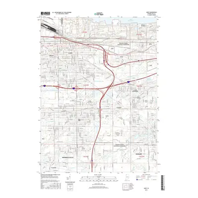
2016 Map of Gary
USGS Topo · Published 2016About this map
Lake Michigan dominates the northern edge of this 2016 survey, where the Indiana Dunes National Lakeshore and Marquette Park Beach provide a natural buffer for the industrial and residential corridors of Gary and Miller. The map captures an era of established urban density transitioning into the surrounding suburbs of Merrillville, Hobart, and Lake Station. Educational and civic anchors such as Indiana University Northwest and Ivy Tech Community College-Northwest are clearly situated within the gridded streetscape of Glen Park.
Find a feature on this map
197 named features on this map. Tap any name to fly to it.
Don’t see what you’re looking for? This feature index may not catch every label — zoom into the map to look around manually.
Map Details
Editions of this 2016 Gary Map
This is the sole edition of this map. No revisions or reprints were ever made.
Other maps of this area

1900 · Toleston
USGS Topo · 1:62,500

1934 · Porter
USGS Topo · 1:48,000

1940 · Porter
USGS Topo · 1:62,500

1953 · St. John
USGS Topo · 1:24,000

1953 · Palmer
USGS Topo · 1:24,000

1953 · Gary
USGS Topo · 1:24,000

1953 · Crown Point
USGS Topo · 1:24,000
1953 · Whiting
USGS Topo · 1:24,000

1953 · Garyton
USGS Topo · 1:24,000

1953 · Ogden Dunes
USGS Topo · 1:24,000