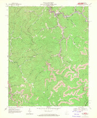
1967 Map of Gary
USGS Topo · Published 1971About this map
Gary and the surrounding coal camps of the West Virginia coalfields are captured in high detail at the end of the 1960s. The landscape is defined by the industrial footprint of the Norfolk and Western railway, which follows the winding course of the Tug Fork and its tributaries like Adkin Creek and Sandlick Creek. The map documents a dense network of extraction, featuring numerous Mines, Air Shafts, and extensive Strip Mines that follow the contour of the ridges. Smaller company towns and settlements such as Thorpe, Elbert, Filbert, and Venus are clustered along the narrow valley floors, while higher elevations like Maxwell Gap remain largely undeveloped except for timber and mining access via the Western Trail. This survey provides a precise record of the regional rail-to-mine infrastructure before subsequent decades of industrial transition changed the character of these McDowell County communities.
Find a feature on this map
48 named features on this map. Tap any name to fly to it.
Don’t see what you’re looking for? This feature index may not catch every label — zoom into the map to look around manually.
Map Details
Editions of this 1967 Gary Map
2 editions found
Other maps of this area

1887 · Pocahontas
USGS Topo · 1:125,000

1891 · Tazewell
USGS Topo · 1:125,000

1891 · Pocahontas
USGS Topo · 1:125,000

1894 · Pocahontas
USGS Topo · 1:125,000

1895 · Tazewell
USGS Topo · 1:125,000

1895 · Pocahontas
USGS Topo · 1:125,000

1897 · Tazewell
USGS Topo · 1:125,000

1909 · Pocahontas Special
USGS Topo · 1:48,000

1911 · Pocahontas Special
USGS Topo · 1:62,500

1912 · Pounding Mill
USGS Topo · 1:62,500