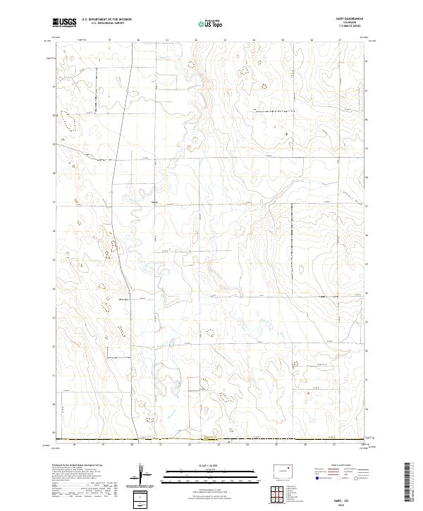
2022 Map of Gary
USGS Topo · Published 2022About this map
The settlement of Gary serves as the focal point of this high plains landscape, situated where the arid terrain begins to give way to drainage systems. This 2022 survey captures the intersection of Morgan County and Washington County, an area defined by its systematic grid of county roads and intermittent waterways. The mapping reveals a sparse but vital hydrologic network where Beaver Creek and Buck Creek cut through the sections, alongside the prominent Shears Draw in the northeast.
Find a feature on this map
29 named features on this map. Tap any name to fly to it.
Don’t see what you’re looking for? This feature index may not catch every label — zoom into the map to look around manually.
Map Details
Editions of this 2022 Gary Map
This is the sole edition of this map. No revisions or reprints were ever made.
Other maps of this area

1954 · Limon
USGS Topo · 1:250,000

1954 · Sterling
USGS Topo · 1:250,000

1957 · Limon
USGS Topo · 1:250,000

1958 · Limon
USGS Topo · 1:250,000

1958 · Sterling
USGS Topo · 1:250,000

1963 · Round Top
USGS Topo · 1:24,000

1965 · Gary
USGS Topo · 1:24,000

1965 · Huey Ranch
USGS Topo · 1:24,000

1965 · Miller Ranch
USGS Topo · 1:24,000

1973 · Woodrow
USGS Topo · 1:24,000