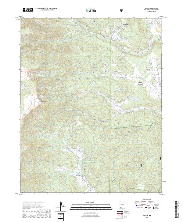
2023 Map of Gascon
USGS Topo · Published 2023About this map
Gascon and the high ridges of the Sangre de Cristo Mountains define this landscape in the northern reaches of the Santa Fe National Forest. The map documents a rugged high-altitude terrain where mountain peaks like Pyramid Peak and Gascon Point overlook a complex network of alpine waters, including Pacheco Lake, Santiago Lake, and the hidden Enchanted Lake. Human settlement is concentrated in the eastern valleys, with the village of Vallecitos and the small community of Pacheco Village situated along the mountain flanks. These areas are connected by traditional routes such as Pacheco Village Rd and Rio la Casa Rd. The map also captures several traditional land-use markers, including the Santo Niño Cem near Monte Aplanado and the controlled waters of Morphy Lake, illustrating the intersection of wild mountain wilderness and established rural communities in Mora County.
Find a feature on this map
42 named features on this map. Tap any name to fly to it.
Don’t see what you’re looking for? This feature index may not catch every label — zoom into the map to look around manually.
Map Details
Editions of this 2023 Gascon Map
This is the sole edition of this map. No revisions or reprints were ever made.
Other maps of this area

1889 · Las Vegas
USGS Topo · 1:125,000

1889 · Santa Fe
USGS Topo · 1:125,000

1891 · Las Vegas
USGS Topo · 1:125,000

1893 · Las Vegas
USGS Topo · 1:125,000

1894 · Santa Fe
USGS Topo · 1:125,000

1954 · Santa Fe
USGS Topo · 1:250,000

1954 · Raton
USGS Topo · 1:250,000

1958 · Raton
USGS Topo · 1:250,000

1958 · Santa Fe
USGS Topo · 1:250,000
1963 · Pecos Falls
USGS Topo · 1:24,000