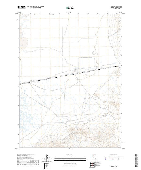
2021 Map of Gaskell
USGS Topo · Published 2021About this map
Desert Valley dominates the northern expanse of this region in Humboldt County, where the topography transitions from the low-lying basin floor to the rising slopes in the southeast. The landscape is defined by the rigid grid of the Public Land Survey System, with township and range lines marking the desert floor. Running nearly east-west across the central portion of the map, Jungo Rd serves as the primary corridor for movement through this arid territory. The sparse labels indicate a focused land-use pattern typical of the high desert, where transport routes follow the path of least resistance across the basin while avoiding the more complex terrain found at the higher elevations to the south.
Find a feature on this map
7 named features on this map. Tap any name to fly to it.
Don’t see what you’re looking for? This feature index may not catch every label — zoom into the map to look around manually.
Map Details
Editions of this 2021 Gaskell Map
This is the sole edition of this map. No revisions or reprints were ever made.
Other maps of this area

1886 · Disaster
USGS Topo · 1:250,000

1893 · Disaster
USGS Topo · 1:250,000

1931 · Lovelock
USGS Topo · 1:250,000

1935 · Lovelock
USGS Topo · 1:250,000

1939 · Eugene Mountains Area
USGS Topo · 1:62,500

1942 · Eugene Mountains Area
USGS Topo · 1:62,500

1954 · Vya
USGS Topo · 1:250,000

1955 · Lovelock
USGS Topo · 1:250,000

1958 · Vya
USGS Topo · 1:250,000

1959 · Lovelock
USGS Topo · 1:250,000