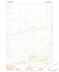
1982 Map of Gaskell
USGS Topo · Published 1982About this map
Gaskell and the surrounding basin of the Alkali Flats appear here during a 1977 field check in Humboldt County. The landscape is defined by the stark contrast between the low-lying basins and the rising slopes of the Eugene Mountains in the south. This area illustrates the resource extraction and water management essential for survival in the high desert, evidenced by the Golden Eagle Mine and infrastructure like Hard Pan Well and Johnson Well.
Find a feature on this map
13 named features on this map. Tap any name to fly to it.
Don’t see what you’re looking for? This feature index may not catch every label — zoom into the map to look around manually.
Map Details
Editions of this 1982 Gaskell Map
This is the sole edition of this map. No revisions or reprints were ever made.
Other maps of this area

1886 · Disaster
USGS Topo · 1:250,000

1893 · Disaster
USGS Topo · 1:250,000

1931 · Lovelock
USGS Topo · 1:250,000

1935 · Lovelock
USGS Topo · 1:250,000

1939 · Eugene Mountains Area
USGS Topo · 1:62,500

1942 · Eugene Mountains Area
USGS Topo · 1:62,500

1954 · Vya
USGS Topo · 1:250,000

1955 · Lovelock
USGS Topo · 1:250,000

1958 · Vya
USGS Topo · 1:250,000

1959 · Lovelock
USGS Topo · 1:250,000