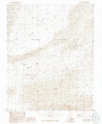
1986 Map of Gass Peak
USGS Topo · Published 1986About this map
Gass Peak dominates this section of the high desert, serving as a prominent landmark within the Desert National Wildlife Range. The landscape is defined by the convergence of the Sheep Range and the Las Vegas Range, where the presence of numerous water sources like White Spot Spring, Upper White Blotch Spring, and Gass Spring indicates the vital importance of these perennial points in an arid environment. The map details the transition from the Yucca Forest in the north to the distinctive geological formations of Fossil Ridge. Scattered prospects across the slopes reflect historical mineral exploration in these mountains, while the lack of established roads highlights the area's role as a protected wilderness during the 1980s.
Find a feature on this map
15 named features on this map. Tap any name to fly to it.
Don’t see what you’re looking for? This feature index may not catch every label — zoom into the map to look around manually.
Map Details
Editions of this 1986 Gass Peak Map
This is the sole edition of this map. No revisions or reprints were ever made.
Other maps of this area

1907 · Las Vegas
USGS Topo · 1:250,000

1908 · Las Vegas
USGS Topo · 1:250,000

1945 · Sheep Range
USGS Topo · 1:125,000

1952 · Corn Creek Springs
USGS Topo · 1:62,500

1952 · Gass Peak
USGS Topo · 1:62,500

1954 · Las Vegas
USGS Topo · 1:250,000

1957 · Las Vegas
USGS Topo · 1:250,000

1959 · Las Vegas
USGS Topo · 1:250,000

1960 · Hayford Peak
USGS Topo · 1:62,500

1962 · Las Vegas
USGS Topo · 1:250,000