
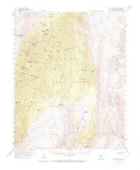
1960 Map of Hayford Peak
USGS Topo · Published 1961About this map
Hayford Peak stands as the literal and figurative height of this survey, presiding over the rugged high-elevation terrain of the Sheep Range. The landscape is a high-desert refuge defined by its rare water sources and high-altitude flora, evidenced by the expansive Yucca Forest and isolated springs like Mormon Well and Yellowjacket Spring. These water points were critical for the early infrastructure of the region, supporting the remote Hidden Forest Cabin and the high-mountain outpost at Pine Nut Camp.
Find a feature on this map
44 named features on this map. Tap any name to fly to it.
Don’t see what you’re looking for? This feature index may not catch every label — zoom into the map to look around manually.
Map Details
Editions of this 1960 Hayford Peak Map
2 editions found
Other maps of this area

1886 · Saint Thomas
USGS Topo · 1:250,000

1893 · Saint Thomas
USGS Topo · 1:250,000

1907 · Las Vegas
USGS Topo · 1:250,000

1908 · Las Vegas
USGS Topo · 1:250,000

1926 · Boulder Canyon
USGS Topo · 1:96,000

1945 · Sheep Range
USGS Topo · 1:125,000

1952 · Corn Creek Springs
USGS Topo · 1:62,500

1952 · Gass Peak
USGS Topo · 1:62,500

1952 · Dry Lake
USGS Topo · 1:62,500

1954 · Las Vegas
USGS Topo · 1:250,000