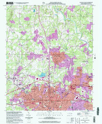
2002 Map of Gastonia North
USGS Topo · Published 2003About this map
Gastonia and its northern outskirts are the focal point of this 2002 update, reflecting decades of suburban expansion and industrial infrastructure. The landscape is defined by the heavy footprint of the Gastonia corporate boundary and the city of Dallas, where established residential areas like Ashebrook Park and Jenkins Heights meet industrial sites such as the Filtration Plant and Long Creek Sewage Disposal. The city's civic and educational heart is well-documented, featuring the Schiele Museum, the State Orthopedic Hosp, and numerous legacy institutions like Highland Jr High Sch and Central Sch.
Find a feature on this map
84 named features on this map. Tap any name to fly to it.
Don’t see what you’re looking for? This feature index may not catch every label — zoom into the map to look around manually.
Map Details
Editions of this 2002 Gastonia North Map
This is the sole edition of this map. No revisions or reprints were ever made.
Other maps of this area

1906 · Kings Mountain
USGS Topo · 1:62,500

1908 · Kings Mountain
USGS Topo · 1:62,500

1909 · Lincolnton
USGS Topo · 1:62,500

1911 · Lincolnton
USGS Topo · 1:62,500

1914 · Gastonia
USGS Topo · 1:48,000

1916 · Gastonia
USGS Topo · 1:62,500

1947 · Clover
USGS Topo · 1:62,500

1949 · Clover
USGS Topo · 1:62,500

1953 · Charlotte
USGS Topo · 1:250,000

1954 · Charlotte
USGS Topo · 1:250,000