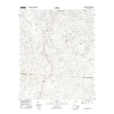
2016 Map of Gastonia South
USGS Topo · Published 2016About this map
Gastonia and its southern reaches define this 2016 study, showcasing the dense residential growth and suburban expansion into South Gastonia and Boogertown. The map traces the transition from urban centers to the agricultural and recreational lands near the South Carolina border, marked by prominent features like the Gastonia Municipal Airport and the sprawling Gaston Country Club Lake. Local history is anchored by numerous spiritual and memorial sites, including Olney Church and the Mount Pleasant Church Cem, which reflect the area's long-established communities.
Find a feature on this map
273 named features on this map. Tap any name to fly to it.
Don’t see what you’re looking for? This feature index may not catch every label — zoom into the map to look around manually.
Map Details
Editions of this 2016 Gastonia South Map
This is the sole edition of this map. No revisions or reprints were ever made.
Other maps of this area

1906 · Kings Mountain
USGS Topo · 1:62,500

1908 · Kings Mountain
USGS Topo · 1:62,500

1909 · Lincolnton
USGS Topo · 1:62,500

1911 · Lincolnton
USGS Topo · 1:62,500

1914 · Gastonia
USGS Topo · 1:48,000

1916 · Gastonia
USGS Topo · 1:62,500

1947 · Clover
USGS Topo · 1:62,500

1949 · Clover
USGS Topo · 1:62,500

1953 · Charlotte
USGS Topo · 1:250,000

1954 · Charlotte
USGS Topo · 1:250,000