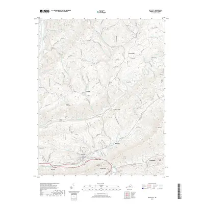
2019 Map of Gate City
USGS Topo · Published 2019About this map
Gate City serves as the focal point of this southwestern Virginia landscape, anchored by the Scott County Courthouse at the intersection of local history and modern infrastructure. The terrain is defined by the parallel ridges of Clinch Mountain and Copper Ridge, which channel the flow of Moccasin Creek and Copper Creek through fertile valleys. This 2019 survey reveals a persistent pattern of rural settlement, where numerous family-named cemeteries—such as Frederick Starnes Cem, Abijah Alley Cem, and Gillenwater Cem—stand as enduring markers of early Appalachian genealogy. The prominence of historical milling sites, including Carrico Mill, Cox Mill, and Jayne Mill, indicates a long-standing reliance on the area's water power, while the proximity of Weber City and Nottingham illustrates the gradual expansion of local communities along the Poor Valley corridor.
Find a feature on this map
141 named features on this map. Tap any name to fly to it.
Don’t see what you’re looking for? This feature index may not catch every label — zoom into the map to look around manually.
Map Details
Editions of this 2019 Gate City Map
This is the sole edition of this map. No revisions or reprints were ever made.
Other maps of this area

1894 · Estillville
USGS Topo · 1:125,000

1897 · Bristol
USGS Topo · 1:125,000

1902 · Bristol
USGS Topo · 1:125,000

1920 · Wise
USGS Topo · 1:48,000

1920 · Coeburn
USGS Topo · 1:48,000

1921 · Wise
USGS Topo · 1:62,500

1935 · Hilton
USGS Topo · 1:24,000

1935 · Moggasin
USGS Topo · 1:48,000

1935 · East Stone Gap
USGS Topo · 1:24,000

1935 · Kingsport
USGS Topo · 1:24,000