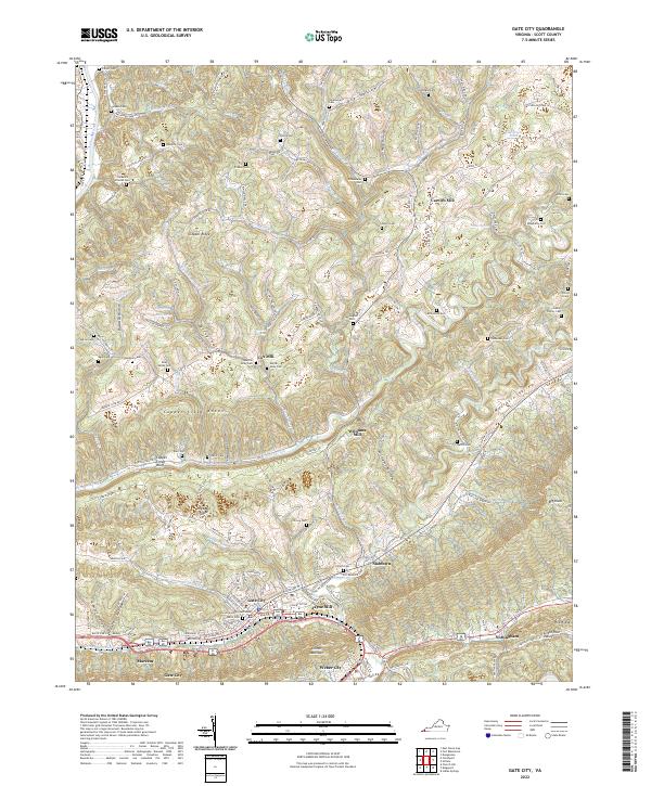
2022 Map of Gate City
USGS Topo · Published 2022About this map
Gate City serves as the focal point of this Scott County landscape, centered near the Scott County Courthouse and the intersection of local commerce. The town's layout is defined by streets like W Jackson St and Kane St, transitioning into the industrial and residential corridors of Weber City and Marcem. The area's agricultural and milling history is evident through numerous named sites along the waterways, including Carrico Mill on Obeys Cr and Jayne Mill near the foot of Clinch Mountain.
Find a feature on this map
146 named features on this map. Tap any name to fly to it.
Don’t see what you’re looking for? This feature index may not catch every label — zoom into the map to look around manually.
Map Details
Editions of this 2022 Gate City Map
This is the sole edition of this map. No revisions or reprints were ever made.
Other maps of this area

1894 · Estillville
USGS Topo · 1:125,000

1897 · Bristol
USGS Topo · 1:125,000

1902 · Bristol
USGS Topo · 1:125,000

1920 · Wise
USGS Topo · 1:48,000

1920 · Coeburn
USGS Topo · 1:48,000

1921 · Wise
USGS Topo · 1:62,500

1935 · Hilton
USGS Topo · 1:24,000

1935 · Moggasin
USGS Topo · 1:48,000

1935 · East Stone Gap
USGS Topo · 1:24,000

1935 · Kingsport
USGS Topo · 1:24,000