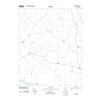
2010 Map of Gatesville
USGS Topo · Published 2010About this map
Gatesville and its surrounding crossroads serve as the focal point for this survey of northeastern North Carolina. The landscape is defined by the winding Chowan River and a dense network of swampy tributaries, including Cypress Swamp and Hackley Swamp. These wetlands dictate the placement of local infrastructure, where long-established road junctions like Ballard Crossroads, Eleanors Crossroads, and Riddick Crossroads emerged as vital points of connection for rural residents.
Find a feature on this map
55 named features on this map. Tap any name to fly to it.
Don’t see what you’re looking for? This feature index may not catch every label — zoom into the map to look around manually.
Map Details
Editions of this 2010 Gatesville Map
This is the sole edition of this map. No revisions or reprints were ever made.
Other maps of this area

1906 · Beckford
USGS Topo · 1:48,000

1907 · Beckford
USGS Topo · 1:62,500

1908 · Winton
USGS Topo · 1:62,500

1919 · Suffolk
USGS Topo · 1:62,500

1920 · Holland
USGS Topo · 1:62,500

1940 · Beckford
USGS Topo · 1:62,500

1943 · Holland
USGS Topo · 1:62,500

1953 · Norfolk
USGS Topo · 1:250,000
1954 · Suffolk
USGS Topo · 1:62,500

1957 · Holland
USGS Topo · 1:62,500