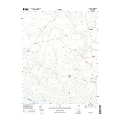
2016 Map of Gatesville
USGS Topo · Published 2016About this map
Gatesville serves as the focal point for this Gates County landscape, situated where the terrain transitions from upland crossroads to the intricate wetlands of the Chowan River basin. The area is defined by its numerous swamp systems and pocosin features, including the Whiteoak Pocosin and Jordan Pocosin, which historically dictated the pattern of local settlement. Smaller communities like Eure, Roduco, and Sarem are linked by a network of rural roads that circumvent the larger water bodies and wetlands. To the south, Rays Beach sits along the river's edge, while the interior is marked by significant millponds such as Lillys Millpond and Taylor Millpond. These water features, alongside the expansive Cypress Swamp, reflect a long-standing reliance on the region's natural hydrology for both early industry and modern drainage.
Find a feature on this map
72 named features on this map. Tap any name to fly to it.
Don’t see what you’re looking for? This feature index may not catch every label — zoom into the map to look around manually.
Map Details
Editions of this 2016 Gatesville Map
This is the sole edition of this map. No revisions or reprints were ever made.
Other maps of this area

1906 · Beckford
USGS Topo · 1:48,000

1907 · Beckford
USGS Topo · 1:62,500

1908 · Winton
USGS Topo · 1:62,500

1919 · Suffolk
USGS Topo · 1:62,500

1920 · Holland
USGS Topo · 1:62,500

1940 · Beckford
USGS Topo · 1:62,500

1943 · Holland
USGS Topo · 1:62,500

1953 · Norfolk
USGS Topo · 1:250,000
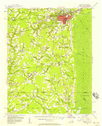
1954 · Suffolk
USGS Topo · 1:62,500

1957 · Holland
USGS Topo · 1:62,500