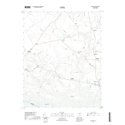
2019 Map of Gatesville
USGS Topo · Published 2019About this map
Gatesville serves as the focal point for this Gates County landscape, positioned near the eastern edge of the survey where local streets like High St and Main St intersect. The surrounding countryside is defined by a dense network of wetlands and minor watercourses, including the extensive Hackley Swamp and the unique terrain of Whiteoak Pocosin. A distinct pattern of rural crossroads settlements, such as Eure, Roduco, and Ballard Crossroads, indicates the historical development of the region's agricultural and transport network.
Find a feature on this map
80 named features on this map. Tap any name to fly to it.
Don’t see what you’re looking for? This feature index may not catch every label — zoom into the map to look around manually.
Map Details
Editions of this 2019 Gatesville Map
This is the sole edition of this map. No revisions or reprints were ever made.
Other maps of this area

1906 · Beckford
USGS Topo · 1:48,000

1907 · Beckford
USGS Topo · 1:62,500

1908 · Winton
USGS Topo · 1:62,500

1919 · Suffolk
USGS Topo · 1:62,500

1920 · Holland
USGS Topo · 1:62,500

1940 · Beckford
USGS Topo · 1:62,500

1943 · Holland
USGS Topo · 1:62,500

1953 · Norfolk
USGS Topo · 1:250,000
1954 · Suffolk
USGS Topo · 1:62,500

1957 · Holland
USGS Topo · 1:62,500