
1947 Map of Gatesville West
USGS Topo · Published 1953About this map
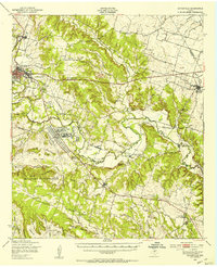
Gatesville serves as the focal point of this central Texas landscape, situated along the banks of the winding Leon River. The post-war era is reflected in the southern portion of the sheet by the Fort Hood Military Reservation, where the Reservation Boundary cuts across a landscape otherwise defined by small-scale rural agriculture. This 1947 survey captures a community structured around its spiritual and educational centers, including Standlee Chapel, Calvary Baptist Ch, and the Plainview Sch. Near the river, the State Reform School stands as a significant institutional landmark. For genealogists, the inclusion of the Hemelline Cem and family-named landmarks like Bald Knob provides specific points for tracing local lineage. The road network, featuring Old Georgetown Road and Pidcoke Road, illustrates the established overland routes connecting these rural outposts.
Find a feature on this map
21 named features on this map. Tap any name to fly to it.
Don’t see what you’re looking for? This feature index may not catch every label — zoom into the map to look around manually.
Map Details
Editions of this 1947 Gatesville West Map
This is the sole edition of this map. No revisions or reprints were ever made.
Other maps of this area

1888 · Meridian
USGS Topo · 1:125,000

1894 · Meridian
USGS Topo · 1:125,000

1894 · Gatesville
USGS Topo · 1:125,000

1947 · Purmela
USGS Topo · 1:62,500

1947 · Pidcoke
USGS Topo · 1:24,000

1947 · North Fort Hood
USGS Topo · 1:24,000

1947 · Purmela
USGS Topo · 1:24,000

1947 · Gatesville East
USGS Topo · 1:24,000

1947 · Shell Mountains
USGS Topo · 1:24,000
1950 · Gatesville
USGS Topo · 1:62,500