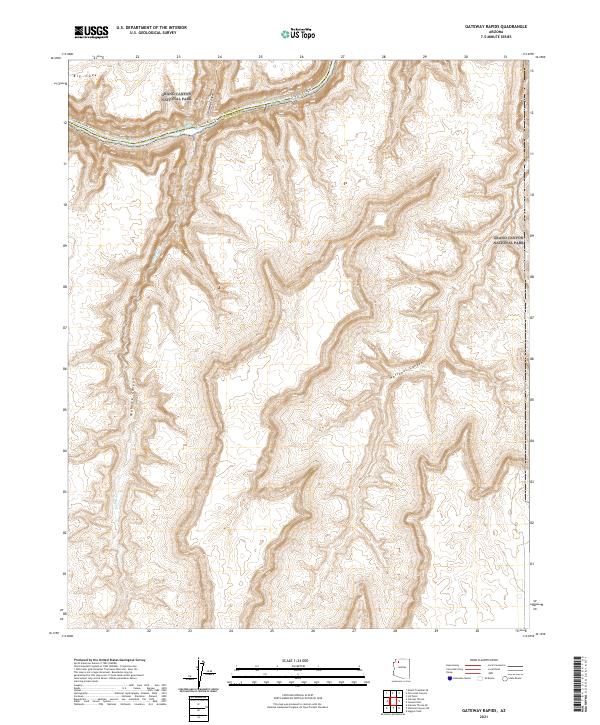
2021 Map of Gateway Rapids
USGS Topo · Published 2021About this map
Grand Canyon National Park encompasses this entire landscape, dominated by the immense relief of the Colorado Plateau. The Colorado River carves through the northern portion of the sheet, where turbulent waters at Gateway Rapids mark a significant point on the river's course. This section of the inner canyon is defined by its dramatic side drainages, including the deep recesses of Stairway Canyon and the expansive Mohawk Canyon. Along the river's edge, the Colorado River Trl provides a primary route for navigation through this wilderness. Further south, the map details the high desert plateau and the headwaters of National Canyon, illustrating the complex network of dry washes and topographic benches that characterize this part of Arizona. The boundary between Mohave and Coconino counties runs directly through the river channel, splitting the northern half of the quadrangle.
Find a feature on this map
17 named features on this map. Tap any name to fly to it.
Don’t see what you’re looking for? This feature index may not catch every label — zoom into the map to look around manually.
Map Details
Editions of this 2021 Gateway Rapids Map
This is the sole edition of this map. No revisions or reprints were ever made.
Other maps of this area

1886 · Mt. Trumbull
USGS Topo · 1:250,000

1886 · Kaibab
USGS Topo · 1:250,000

1892 · Mt. Trumbull
USGS Topo · 1:250,000

1953 · Grand Canyon
USGS Topo · 1:250,000

1957 · Grand Canyon
USGS Topo · 1:250,000

1958 · Grand Canyon
USGS Topo · 1:250,000

1960 · Grand Canyon
USGS Topo · 1:250,000

1962 · Tuckup Canyon
USGS Topo · 1:62,500

1962 · National Canyon
USGS Topo · 1:62,500
1967 · Vulcans Throne
USGS Topo · 1:24,000